
|
January 6, 2014 |
|
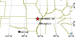
Maynard, ARRandolph County, Arkansas
Latitude: 36.418200 Longitude: -90.902166Population 369 (2005)Elevation of Maynard, Arkansas: 381 feet |
|
Population 2005: 369 Population 2004: 371 Population 2003: 370 Population 2002: 374 Population 2001: 378 Population 2000: 381 (2000 Census) Population 1990: 354 (1990 Census) Population Growth 2000 to 2005: -3.15% Population Growth 1990 to 2000: 7.63% Population (2000 Census): 381 Male: 178 (46.72%) Female: 203 (53.28%) Median age: 40.30 years Races, 2000 Census: White: 95.80% Two or more races: 1.57% American Indian: 1.31% Hispanic or Latino: 1.05% Other race: 0.79% Housing Units: 207 (2000 Census) Land Area: 1.1345 square miles Most populous zip code: 72444 |
 |