
|
January 6, 2014 |
|
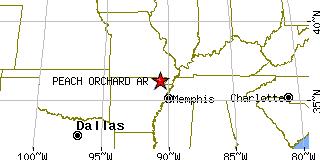
Peach Orchard, ARClay County, Arkansas
Latitude: 36.279666 Longitude: -90.663871Population 184 (2005)Elevation of Peach Orchard, Arkansas: 285 feet |
|
Population 2005: 184 Population 2004: 186 Population 2003: 187 Population 2002: 189 Population 2001: 192 Population 2000: 195 (2000 Census) Population 1990: 197 (1990 Census) Population Growth 2000 to 2005: -5.64% Population Growth 1990 to 2000: -1.02% Population (2000 Census): 195 Male: 92 (47.18%) Female: 103 (52.82%) Median age: 40.40 years Races, 2000 Census: White: 97.44% Other race: 2.56% Housing Units: 97 (2000 Census) Land Area: 0.9851 square miles Most populous zip code: 72453 |
 |