
|
January 6, 2014 |
|
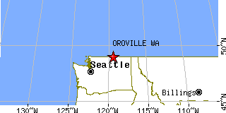
Oroville, WAOkanogan County, Washington
Latitude: 48.938508 Longitude: -119.434903Population 1,599 (2005)Elevation of Oroville, Washington: 930 feet |
|
Population 2005: 1,599 Population 2004: 1,600 Population 2003: 1,594 Population 2002: 1,613 Population 2001: 1,633 Population 2000: 1,653 (2000 Census) Population 1990: 1,505 (1990 Census) Population Growth 2000 to 2005: -3.27% Population Growth 1990 to 2000: 9.83% Population (2000 Census): 1,653 Male: 801 (48.46%) Female: 852 (51.54%) Median age: 38.30 years Races, 2000 Census: White: 75.80% Hispanic or Latino: 17.06% Other race: 9.32% American Indian: 4.23% Two or more races: 3.39% Native Hawaiian / Other Pacific Islander: 0.30% Black or African American: 0.12% Housing Units: 794 (2000 Census) Land Area: 1.2368 square miles Water Area: 0.0135 square miles Most populous zip code: 98844 |
 |