
|
January 6, 2014 |
|
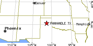
Panhandle, TXCarson County, Texas
Latitude: 35.347409 Longitude: -101.381997Population 2,609 (2005) |
|
Population 2005: 2,609 Population 2004: 2,571 Population 2003: 2,574 Population 2002: 2,603 Population 2001: 2,538 Population 2000: 2,589 (2000 Census) Population 1990: 2,353 (1990 Census) Population Growth 2000 to 2005: 0.77% Population Growth 1990 to 2000: 10.03% Population (2000 Census): 2,589 Male: 1,231 (47.55%) Female: 1,358 (52.45%) Median age: 37.80 years Races, 2000 Census: White: 88.84% Hispanic or Latino: 8.96% Other race: 3.86% Two or more races: 1.47% American Indian: 0.77% Black or African American: 0.66% Asian: 0.08% Housing Units: 1,014 (2000 Census) Land Area: 2.1281 square miles Most populous zip code: 79068 |
 |