
|
January 6, 2014 |
|
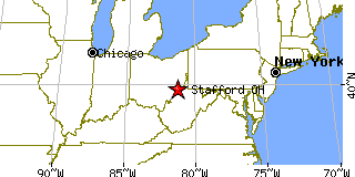
Stafford, OHMonroe County, Ohio
Latitude: 39.713226 Longitude: -81.277435Population 85 (2005)Elevation of Stafford, Ohio: 1080 feet |
|
Population 2005: 85 Population 2004: 86 Population 2003: 86 Population 2002: 85 Population 2001: 86 Population 2000: 86 (2000 Census) Population 1990: 89 (1990 Census) Population Growth 2000 to 2005: -1.16% Population Growth 1990 to 2000: -3.37% Population (2000 Census): 86 Male: 42 (48.84%) Female: 44 (51.16%) Median age: 42.50 years Races, 2000 Census: White: 98.84% American Indian: 1.16% Housing Units: 42 (2000 Census) Land Area: 0.3382 square miles Most populous zip code: 43786 |
 |