
|
January 6, 2014 |
|
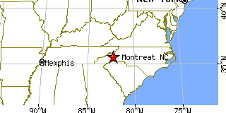
Montreat, NCBuncombe County, North Carolina
Latitude: 35.645590 Longitude: -82.300434Population 661 (2005)Elevation of Montreat, North Carolina: 6368 feet |
|
Population 2005: 661 Population 2004: 659 Population 2003: 685 Population 2002: 673 Population 2001: 628 Population 2000: 630 (2000 Census) Population 1990: 693 (1990 Census) Population Growth 2000 to 2005: 4.92% Population Growth 1990 to 2000: -9.09% Population (2000 Census): 630 Male: 319 (50.63%) Female: 311 (49.37%) Median age: 22.80 years Races, 2000 Census: White: 94.92% Two or more races: 1.59% Hispanic or Latino: 1.43% Black or African American: 0.95% Other race: 0.79% American Indian: 0.63% Housing Units: 572 (2000 Census) Land Area: 2.7722 square miles Water Area: 0.0031 square miles Most populous zip code: 28757 |
 |