
|
January 6, 2014 |
|
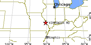
Kimmswick, MOJefferson County, Missouri
Latitude: 38.366654 Longitude: -90.364217Population 93 (2005) |
|
Population 2005: 93 Population 2004: 93 Population 2003: 94 Population 2002: 92 Population 2001: 93 Population 2000: 94 (2000 Census) Population 1990: 135 (1990 Census) Population Growth 2000 to 2005: -1.06% Population Growth 1990 to 2000: -30.37% Population (2000 Census): 94 Male: 43 (45.74%) Female: 51 (54.26%) Median age: 40.40 years Races, 2000 Census: White: 89.36% Two or more races: 9.57% Black or African American: 1.06% Housing Units: 36 (2000 Census) Land Area: 0.0792 square miles Most populous zip code: 63053 |
 |