U.S. Beacon January 6, 2014

Hurley, MO

Stone County, Missouri

Latitude: 36.932333     Longitude: -93.497979
Population 160 (2005)
Hurley is located in STONE county, Missouri at latitude 36.932333 and longitude -93.497979. The population of Hurley is 160 as of the year 2005 with a population growth of 1.91% from the year 2000 through 2005. The most common zip code of Hurley is 65675.

More data for Hurley,MO: Demographic Profile - Social Profile - Economic Profile - Housing Profile

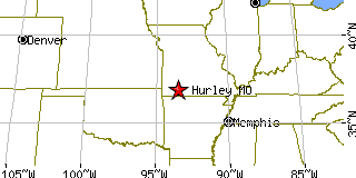
Population 2005: 160
Population 2004: 160
Population 2003: 157
Population 2002: 154
Population 2001: 151
Population 2000: 157 (2000 Census)
Population 1990: 87 (1990 Census)

Population Growth 2000 to 2005: 1.91%
Population Growth 1990 to 2000: 80.46%

Population (2000 Census): 157
Male: 72 (45.86%)
Female: 85 (54.14%)

Median age: 29.10 years

Races, 2000 Census:
White: 98.09%
Two or more races: 1.27%
American Indian: 0.64%

Housing Units: 63 (2000 Census)
Land Area: 0.3326 square miles

Most populous zip code: 65675


Cities & Towns nearby Hurley

Crane, MO 4.5mi WSW
Clever, MO 6.8mi NNE
Galena, MO 8.9mi S
Marionville, MO 9.1mi WNW
Ponce De Leon, MO 9.4mi ESE
Billings, MO 9.6mi NNW
Mccord Bend, MO 10mi S
Highlandville, MO 11.7mi E
Spokane, MO 11.8mi ESE
Aurora, MO 12.6mi WNW


More data for Hurley,MO: Demographic Profile - Social Profile - Economic Profile - Housing Profile


US Beacon Home