
|
January 6, 2014 |
|
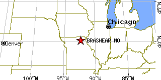
Brashear, MOAdair County, Missouri
Latitude: 40.147868 Longitude: -92.377565Population 272 (2005)Elevation of Brashear, Missouri: 863 feet |
|
Population 2005: 272 Population 2004: 273 Population 2003: 272 Population 2002: 277 Population 2001: 277 Population 2000: 280 (2000 Census) Population 1990: 318 (1990 Census) Population Growth 2000 to 2005: -2.86% Population Growth 1990 to 2000: -11.95% Population (2000 Census): 280 Male: 139 (49.64%) Female: 141 (50.36%) Median age: 41.00 years Races, 2000 Census: White: 96.43% Two or more races: 2.50% Hispanic or Latino: 1.43% Other race: 0.36% Housing Units: 142 (2000 Census) Land Area: 0.3514 square miles Most populous zip code: 63533 |
 |