
|
January 6, 2014 |
|
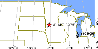
Walnut Grove, MNRedwood County, Minnesota
Latitude: 44.223663 Longitude: -95.468891Population 561 (2005)Elevation of Walnut Grove, Minnesota: 1212 feet |
|
Population 2005: 561 Population 2004: 564 Population 2003: 569 Population 2002: 576 Population 2001: 588 Population 2000: 599 (2000 Census) Population 1990: 625 (1990 Census) Population Growth 2000 to 2005: -6.34% Population Growth 1990 to 2000: -4.16% Population (2000 Census): 599 Male: 283 (47.25%) Female: 316 (52.75%) Median age: 46.10 years Races, 2000 Census: White: 97.66% Native Hawaiian / Other Pacific Islander: 1.17% Black or African American: 0.67% American Indian: 0.17% Housing Units: 341 (2000 Census) Land Area: 1.0368 square miles Most populous zip code: 56180 |
 |