
|
January 6, 2014 |
|
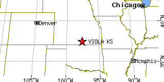
Viola, KSSedgwick County, Kansas
Latitude: 37.483526 Longitude: -97.644918Population 213 (2005)Elevation of Viola, Kansas: 1335 feet |
|
Population 2005: 213 Population 2004: 213 Population 2003: 214 Population 2002: 214 Population 2001: 213 Population 2000: 211 (2000 Census) Population 1990: 185 (1990 Census) Population Growth 2000 to 2005: 0.95% Population Growth 1990 to 2000: 14.05% Population (2000 Census): 211 Male: 105 (49.76%) Female: 106 (50.24%) Median age: 31.80 years Races, 2000 Census: White: 95.73% American Indian: 2.37% Hispanic or Latino: 1.42% Two or more races: 0.95% Other race: 0.47% Housing Units: 79 (2000 Census) Land Area: 0.1584 square miles Most populous zip code: 67149 |
 |