
|
January 6, 2014 |
|
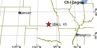
Udall, KSCowley County, Kansas
Latitude: 37.386991 Longitude: -97.117808Population 766 (2005)Elevation of Udall, Kansas: 1267 feet |
|
Population 2005: 766 Population 2004: 779 Population 2003: 780 Population 2002: 795 Population 2001: 783 Population 2000: 794 (2000 Census) Population 1990: 824 (1990 Census) Population Growth 2000 to 2005: -3.53% Population Growth 1990 to 2000: -3.64% Population (2000 Census): 794 Male: 382 (48.11%) Female: 412 (51.89%) Median age: 28.40 years Races, 2000 Census: White: 94.21% Hispanic or Latino: 3.27% American Indian: 1.64% Two or more races: 0.76% Other race: 0.63% Asian: 0.25% Housing Units: 322 (2000 Census) Land Area: 0.4825 square miles Most populous zip code: 67146 |
 |