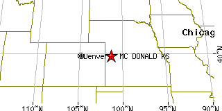
MC DONALD is located in RAWLINS county, Kansas at latitude 39.792736 and longitude -101.363322. The population of MC DONALD is 356 as of the year 2000. The most common zip code of MC DONALD is
67745.
|
|
Population 2000: 356 (2000 Zip Code Based Est.)
Housing Units: 212 (2000 Zip Code Based Est.)
Land Area: 227.3793 square miles
Most populous zip code: 67745
|
 |

|
Cities & Towns nearby Mc Donald
Mcdonald, KS 0.6mi SW
Bird City, KS 9.5mi WSW
Atwood, KS 17.1mi E
Benkelman, NE 20mi NNW
Ludell, KS 23mi ENE
St. Francis, KS 23.3mi W
Max, NE 24.3mi N
Saint Francis, KS 24.4mi W
Stratton, NE 25.6mi NNE
Levant, KS 27.5mi SSE
US Beacon Home