
|
January 6, 2014 |
|
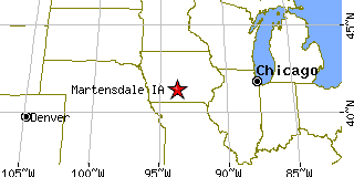
Martensdale, IAWarren County, Iowa
Latitude: 41.373148 Longitude: -93.739661Population 459 (2005)Elevation of Martensdale, Iowa: 830 feet |
|
Population 2005: 459 Population 2004: 462 Population 2003: 465 Population 2002: 463 Population 2001: 462 Population 2000: 467 (2000 Census) Population 1990: 491 (1990 Census) Population Growth 2000 to 2005: -1.71% Population Growth 1990 to 2000: -4.89% Population (2000 Census): 467 Male: 221 (47.32%) Female: 246 (52.68%) Median age: 36.10 years Races, 2000 Census: White: 98.07% Hispanic or Latino: 1.71% Two or more races: 0.64% American Indian: 0.43% Other race: 0.21% Housing Units: 181 (2000 Census) Land Area: 0.3777 square miles Most populous zip code: 50160 |
 |