U.S. Beacon January 6, 2014

Emerson, IA

Mills County, Iowa

Latitude: 41.018506     Longitude: -95.401975
Population 497 (2005)
EMERSON is located in MILLS county, Iowa at latitude 41.018506 and longitude -95.401975. The population of EMERSON is 497 as of the year 2005 with a population growth of 3.54% from the year 2000 through 2005. The most common zip code of EMERSON is 51533.

More data for Emerson,IA: Demographic Profile - Social Profile - Economic Profile - Housing Profile

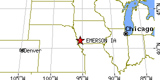
Population 2005: 497
Population 2004: 489
Population 2003: 486
Population 2002: 486
Population 2001: 479
Population 2000: 480 (2000 Census)
Population 1990: 476 (1990 Census)

Population Growth 2000 to 2005: 3.54%
Population Growth 1990 to 2000: 0.84%

Population (2000 Census): 480
Male: 225 (46.88%)
Female: 255 (53.13%)

Median age: 38.50 years

Races, 2000 Census:
White: 98.54%
Two or more races: 0.63%
Other race: 0.21%

Housing Units: 208 (2000 Census)
Land Area: 0.2508 square miles

Most populous zip code: 51533


Cities & Towns nearby Emerson

Hastings, IA 5mi W
Henderson, IA 8.5mi N
Red Oak, IA 9.1mi E
Malvern, IA 9.6mi W
Imogene, IA 9.8mi S
Coburg, IA 10mi SE
Macedonia, IA 12.1mi N
Randolph, IA 13.2mi SW
Essex, IA 13.8mi SSE
Silver City, IA 13.9mi WNW


More data for Emerson,IA: Demographic Profile - Social Profile - Economic Profile - Housing Profile


US Beacon Home