

|
January 6, 2014 |
|
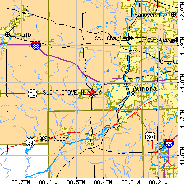
Sugar Grove, ILKane County, Illinois
Latitude: 41.772529 Longitude: -88.442374Population 8,416 (2005)Elevation of Sugar Grove, Illinois: 672 feet |
|
Population 2005: 8,416 Population 2004: 7,586 Population 2003: 6,692 Population 2002: 5,503 Population 2001: 4,542 Population 2000: 3,909 (2000 Census) Population 1990: 2,005 (1990 Census) Population Growth 2000 to 2005: 115.30% Population Growth 1990 to 2000: 94.96% Population (2000 Census): 3,909 Male: 1,979 (50.63%) Female: 1,930 (49.37%) Median age: 34.60 years Races, 2000 Census: White: 92.76% Hispanic or Latino: 4.43% Black or African American: 1.38% Other race: 1.28% Two or more races: 0.95% Asian: 0.51% American Indian: 0.03% Housing Units: 1,297 (2000 Census) Land Area: 6.4492 square miles Water Area: 0.0154 square miles Most populous zip code: 60554 |
 |