
|
January 6, 2014 |
|
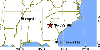
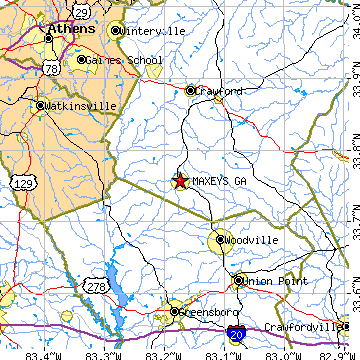
Maxeys, GAOglethorpe County, Georgia
Latitude: 33.757304 Longitude: -83.173873Population 212 (2005)Elevation of Maxeys, Georgia: 753 feet |
|
Population 2005: 212 Population 2004: 216 Population 2003: 219 Population 2002: 218 Population 2001: 214 Population 2000: 210 (2000 Census) Population 1990: 180 (1990 Census) Population Growth 2000 to 2005: 0.95% Population Growth 1990 to 2000: 16.67% Population (2000 Census): 210 Male: 101 (48.10%) Female: 109 (51.90%) Median age: 41.50 years Races, 2000 Census: White: 92.38% Other race: 2.86% Two or more races: 1.43% American Indian: 0.48% Housing Units: 86 (2000 Census) Land Area: 2.3908 square miles Water Area: 0.0098 square miles Most populous zip code: 30671 |
 |