
|
January 6, 2014 |
|
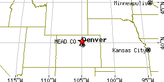
Mead, COWeld County, Colorado
Latitude: 40.224781 Longitude: -104.988573Population 2,663 (2005)Elevation of Mead, Colorado: 5001 feet |
|
Population 2005: 2,663 Population 2004: 2,331 Population 2003: 2,160 Population 2002: 2,185 Population 2001: 2,136 Population 2000: 2,017 (2000 Census) Population 1990: 456 (1990 Census) Population Growth 2000 to 2005: 32.03% Population Growth 1990 to 2000: 342.32% Population (2000 Census): 2,017 Male: 1,016 (50.37%) Female: 1,001 (49.63%) Median age: 33.90 years Races, 2000 Census: White: 91.42% Hispanic or Latino: 6.94% Other race: 1.83% Two or more races: 1.24% American Indian: 0.59% Asian: 0.50% Black or African American: 0.15% Housing Units: 663 (2000 Census) Land Area: 4.3076 square miles Water Area: 0.1171 square miles Most populous zip code: 80542 |
 |