
|
January 6, 2014 |
|
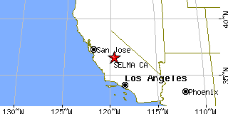
Selma, CAFresno County, California
Latitude: 36.572699 Longitude: -119.612752Population 22,261 (2005) |
|
Population 2005: 22,261 Population 2004: 21,895 Population 2003: 21,209 Population 2002: 20,498 Population 2001: 20,089 Population 2000: 19,444 (2000 Census) Population 1990: 14,757 (1990 Census) Population Growth 2000 to 2005: 14.49% Population Growth 1990 to 2000: 31.76% Population (2000 Census): 19,444 Male: 9,744 (50.11%) Female: 9,700 (49.89%) Median age: 28.40 years Races, 2000 Census: Hispanic or Latino: 71.75% Other race: 46.09% White: 22.28% Two or more races: 4.48% Asian: 3.18% American Indian: 1.56% Black or African American: 0.75% Native Hawaiian / Other Pacific Islander: 0.03% Housing Units: 5,815 (2000 Census) Land Area: 4.3444 square miles Most populous zip code: 93662 |
 |