
|
January 6, 2014 |
|
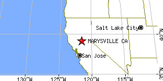
Marysville, CAYuba County, California
Latitude: 39.149343 Longitude: -121.585544Population 12,131 (2005)Elevation of Marysville, California: 63 feet |
|
Population 2005: 12,131 Population 2004: 12,491 Population 2003: 12,599 Population 2002: 12,558 Population 2001: 12,454 Population 2000: 12,268 (2000 Census) Population 1990: 12,324 (1990 Census) Population Growth 2000 to 2005: -1.12% Population Growth 1990 to 2000: -0.45% Population (2000 Census): 12,268 Male: 6,122 (49.90%) Female: 6,146 (50.10%) Median age: 32.40 years Races, 2000 Census: White: 65.77% Hispanic or Latino: 17.54% Other race: 10.10% Asian: 5.99% Two or more races: 5.67% Black or African American: 4.80% American Indian: 2.30% Native Hawaiian / Other Pacific Islander: 0.19% Housing Units: 4,999 (2000 Census) Land Area: 3.5040 square miles Water Area: 0.1237 square miles Most populous zip code: 95901 |
 |