
|
January 6, 2014 |
|
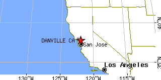
Danville, CAContra Costa County, California
Latitude: 37.811476 Longitude: -121.974192Population 41,852 (2005)Elevation of Danville, California: 368 feet |
|
Population 2005: 41,852 Population 2004: 41,973 Population 2003: 42,439 Population 2002: 42,390 Population 2001: 42,294 Population 2000: 41,715 (2000 Census) Population 1990: 31,306 (1990 Census) Population Growth 2000 to 2005: 0.33% Population Growth 1990 to 2000: 33.25% Population (2000 Census): 41,715 Male: 20,228 (48.49%) Female: 21,487 (51.51%) Median age: 39.90 years Races, 2000 Census: White: 82.99% Asian: 9.00% Hispanic or Latino: 4.66% Two or more races: 2.55% Black or African American: 0.92% Other race: 0.91% American Indian: 0.21% Native Hawaiian / Other Pacific Islander: 0.12% Housing Units: 15,130 (2000 Census) Land Area: 18.0930 square miles Most populous zip code: 94526 |
 |