

|
January 6, 2014 |
|
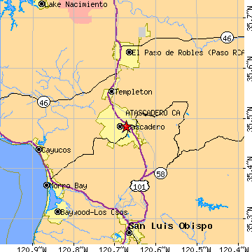
Atascadero, CASan Luis Obispo County, California
Latitude: 35.484283 Longitude: -120.672486Population 27,130 (2005)Elevation of Atascadero, California: 880 feet |
|
Population 2005: 27,130 Population 2004: 27,144 Population 2003: 27,023 Population 2002: 26,812 Population 2001: 26,764 Population 2000: 26,411 (2000 Census) Population 1990: 23,138 (1990 Census) Population Growth 2000 to 2005: 2.72% Population Growth 1990 to 2000: 14.15% Population (2000 Census): 26,411 Male: 13,605 (51.51%) Female: 12,806 (48.49%) Median age: 38.20 years Races, 2000 Census: White: 82.73% Hispanic or Latino: 10.54% Two or more races: 3.34% Other race: 3.19% Black or African American: 2.36% Asian: 1.27% American Indian: 0.94% Native Hawaiian / Other Pacific Islander: 0.11% Housing Units: 9,848 (2000 Census) Land Area: 26.7359 square miles Water Area: 0.0386 square miles Most populous zip code: 93422 |
 |