

|
January 6, 2014 |
|
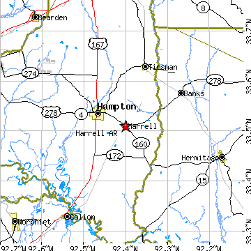
Harrell, ARCalhoun County, Arkansas
Latitude: 33.510471 Longitude: -92.400072Population 286 (2005)Elevation of Harrell, Arkansas: 204 feet |
|
Population 2005: 286 Population 2004: 283 Population 2003: 286 Population 2002: 289 Population 2001: 287 Population 2000: 293 (2000 Census) Population 1990: 258 (1990 Census) Population Growth 2000 to 2005: -2.39% Population Growth 1990 to 2000: 13.57% Population (2000 Census): 293 Male: 133 (45.39%) Female: 160 (54.61%) Median age: 34.40 years Races, 2000 Census: Black or African American: 56.31% White: 43.00% Two or more races: 0.68% Housing Units: 139 (2000 Census) Land Area: 0.6208 square miles Most populous zip code: 71745 |
 |